Class of 2019, Welcome to the PCT Southern Terminus

Imagine learning about a challenge that somehow calls to you. It might be a mountain you’d like to climb, a sea you’d like to sail, a trail you’d like to hike. You research, study, plan and execute. You make arrangements, your life is changed, career perhaps put on hold, relationships interrupted. But that challenge is before you, like a beacon. It becomes your cause. You work toward it. And the day to set forth is finally upon you.

img_9230

As the PCT Southern Terminus hosts for the 2019 season, we are fortunate enough to see hikers who dreamed of a challenge on the Pacific Crest Trail. They have worked for this moment of arriving at the Southern Terminus. This is the traditional trailhead for the northbound thru-hikers. Some come by bus or a hired car, some are dropped off by trail angels, friends or parents; and some of those parents are in tears, scared of the dangers they fear may lay ahead for their child. Some come to solo, some will hike with friends. It seems to us that even strangers make friends quickly. They mostly all have smiles on their faces. Some admit nervousness but everyone seems excited. Many take in the scene and linger and take pictures for up to an hour. Others take a quick selfie and walk directly to the trail, determination already set in.

It’s exciting to see the hikers leave. Each time someone takes off, we think he or she takes a little piece of us as we wish we, too, could be on the trail. But hosting at the Southern Terminus gives us a great opportunity to be part of so many people’s incredible experiences. They are engaging in a challenge they once could only dream about.

Posing

Getting just the right picture is serious business for PCT thru-hikers. Many of the hikers will linger for an hour taking shots that capture the moment, embracing the magic.

Our main focus is to reinforce Leave No Trace (LNT) principles for hikers, day and section hikers, included. The impact hikers have on the trail can be significant, especially the first 100 or so miles. This islikely one of the most used sections. With each hiker we meet, we try to discuss concepts that include respecting the rich riparian areas along the trail, including the ethic of pitching tents 200 feet away from water. This allows plants to grow and animals a chance to get water and thrive in the desert. We discuss the importance of packing out used toilet paper. We speak about fire safety and about respecting wildlife and each other. We also illustrate what is the best ground type for setting up camp. Another priority is reinforcing safety education as part of the PCTA’s “safe and responsible use” campaign. We go over the water report and where to access it. We advise worried hikers on what they need to know for their first miles on the trail. Additionally, as part of an effort to assess and improve the permitting system, we ask if hikers have permits and if they have come to the trailhead on their assigned date. We’re volunteers who care about sustainable use, and we’re not here to enforce the permits. We are gathering accurate information so that the U.S. Forest Service and the PCTA can meaningfully assess how the federal inter-agency permit system is working. We encourage all hikers to be honest with their responses.

img_9149

This has also been a wonderful opportunity to meet, work with and learn from the staff of both the U.S. Forest Service and the PCTA. These organizations collaborate to make this volunteer position possible. We are learning that there is nuance and detail in forest management well beyond what we imagined.

If we all could follow LNT principles and commit to becoming good stewards of the PCT and the outdoors, we will preserve the trail’s legacy while assuring its continued existence. It’s our great hope that as all of you in the Class of 2019 travel north, you will enjoy your time, fall in love with the trail and join us in stewarding it for future generations of hikers.

This post is being published concurrently by the Pacific Crest Trail Association – PCTA.org

Hosting at the Southern Terminus

IMG_8693

Sunrise at the Pacific Crest Trail Southern Terminus.

We’ve been having a lot of fun hanging out at the PCT Southern Terminus in Campo, CA, working on behalf of the Pacific Crest Trail Association and the US forest Service. We were selected from a batch of applicants to act as a last-minute resource for the thru-hikers beginning the annual hiker season starting right about now.

Our primary purpose is to conduct a short survey about the PCTA permitting system. The goal is to collect enough meaningful data to assess what might be done to improve the system. We have met roughly 20 hikers a day for the last week. We expect that number to grow to 50 or more by mid-April. Most hikers probably want to take off right around then. But because of the sheer number of permit applicants, the beginning dates have stretched further to include earlier dates on the front end and later on the back end. I learned that last year, there were roughly 5600 permits issued. That is a huge increase from years prior to 2012. That is the year, I believe, that the move “Wild” premiered. That created a lot of interest in the trail from a wider group of people and the numbers of people wanting to hike the trail grew accordingly.

We started the position with a 1-week training period. During that time, we hung out with staff members of the Forest Service. Two “Crest Runners,” whose role is to monitor the first section up to mile 110 showed us around and gave us a lot of input on what LEAVE NO TRACE principles we wanted to reinforce with the hikers. They helped hone down our “schpiel.” Their job is not easy. They cover a huge territory, hiking and maintaining Section A of the trail, while also educating the public. Unlike Patti and me (thankfully), the Crest Runners are authorized to enforce rules.

As a complete fluke of thought, I started taking photographs of the hikers at the terminus monument before they depart on their big adventures. And then posting them to Instagram and Facebook PCT pages at the end of each day. The response has been overwhelming. We’ve really enjoyed the comments. I’ll do the best I can to continue including as many hikers as possible.

We work 6 days a week from 7AM to Noon. Our day off floats week-to-week. With open afternoons, we hope to get some site-seeing done. Tomorrow, after our work at the terminus, we plan on visiting the desert to see the super bloom said to be taking place right now in the San Diego desert.

If you’d like to see the portraits I mentioned above, please visit our Instagram account McShap.

PCT Completion Hike – Days 65 to 79

The phoenix must burn to emerge.
– Janet Fitch

From Shelter Cover, we continued hiking north, crossing Highway 58 before climbing along a fairly steep, long incline toward the Rosary Lakes area. This is a region that actually contains a series of three lakes, one feeding into the others. The views here were incredible and we had clear, fresh air to enjoy.

Hiking in Oregon during late July and early August, was a perfect time to be there. The temperatures were in the upper 70’s or low 80’s, we didn’t experience a lot of humidity and ripe huckleberries abound. With so many lakes and ponds, we managed to either have lunch or camp overnight almost entirely by water. At Maidu Lake, a mile off trail, the water was so warm that even Patti ventured in. There was also the most incredible number of half-inch sized frogs leaping and jumping all around the banks. It was hard not to step on the little guys. Other lakes we enjoyed were Bobby Lake, Charlton Pond, Taylor Lake, among many more.

I was fascinated by one section-hiker’s itinerary/strategy on hiking the trail. He drives a truck towing a trailer that carries his scooter. He drives to his planned end-point, drops off his scooter, then drives the truck to the trail head and leaves it there. He does his hike to his scooter and then rides that back to his truck. As section hikers ourselves, we spend a lot of time figuring out how to get to and from our trail heads. This guy had it down.

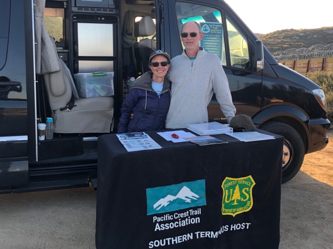
One of the greatest things about the Pacific Crest Trail is the help hikers receive from complete strangers. This often takes the form of a hitch into town or a water cache left for thirsty hikers through a dry area. More commonly, however, trail magic includes these folks hanging out near a trail head and providing fresh food and drinks to the hikers as they pass by. At Charlton Pond, Patti and I were greeted by Hannah and “Sparkles” who was a hiker herself. It was late in the day, almost dark, in fact. But as we approached we saw an eager Hannah waving her hand, chanting “You Who” at us. Next thing we know we’re eating pancakes with lots of squeeze butter and maple syrup, chips and salsa, candy and drinking nice cold local beer. We gorged ourselves after a long day of hiking before setting up camp on the banks of the pond. Then, in the morning, before moving on, we were walking by the area that Hannah and Sparkles were camped at, only to be offered fresh eggs and fruit. The generosity of these trail angels, and all trail angels, is a testimony of how good people can be – something we can easily forget living our lives day-to-day. Hannah and Sparkles provided magic for four solid days, hauling their supplies and food, including ice and cans of beer, into the forest, to more than 80 hikers by the time were leaving. Their generosity was amazing. They would not accept our donation to help with their costs. This was entirely on them.

The impact of fire, past and present, was visible as we moved on. Patti and I saw these areas in different lights. Patti saw the near-baron landscape, but pointed to the small flowers and sprouting green grass as a sign of beauty, remembering that life restores itself in these burn areas. And while I understand that, I was more pessimistic by seeing only the devastation that the fires produced. I was often frustrated by the number of miles we hiked through burn areas, regretting that we were missing what the fires destroyed. This yin/yang between us is good. It gives us something to talk about. In the meantime, however, smoke from the current fires from the region returned and dogged us for the next several days.

Soon after this, we met up with a hiker mentioned in an earlier post, Tequila John. We hiked together for a few days before parting ways, at least temporarily (or so we thought). But not before having a long, hard day walking into Olallie Lake. The three of us were so happy to finally get there at the end of the day, we celebrated with beer and a late dinner. The facility is within a National Forest and has a general store but no restaurant. So, dinner was still trail food. But we all enjoyed a late night before heading to bed. The next morning, we had an 8-mile climb we weren’t looking forward to. I think the beers and camaraderie from the night help us for the climb, even if the cost was in hours of sleep.

Patti and I wanted to attend PCT Days in Cascade Locks on the weekend of August 18. This is a big annual event put on by the Pacific Crest Trail Association. So, we hitched rides to Cascade Locks that Friday, leaving Tequila John at Frog Lake at Highway 26. We made plans to meet him back at Cascade Locks on the following Wednesday after he hikes into town there on Monday. He would take two days off while Patti and I would return to Frog Lake and hike back to Cascade Locks. As I type this it all seems overly complicated, but it all made perfect sense when the plans were made. PCT Days is a time to meet vendors and gear manufacturers, see what’s new in the areas of hiking and outdoor sports, and to network with and learn from some of the elite in the field. We were also able to meet with the PCTA’s Jack Haskell. We had lots of questions and concerns about the smoke and fire we were hearing about in Washington. We were only about 60 miles short from the state border and we had concerns. The news was not good. New fires erupted in several areas in the state, smoke was reportedly heavy. Some of the trail was closed. In fact the last 60 miles of trail, leading up to and including the Northern Terminus of the trail, was now closed with no walk-around yet established. Many hikers were moving on hoping for the best. But Jack made several good points about not moving forward. We now had a lot to think about. There at Cascade Locks, the air was clear. In fact, it was a beautifully sunny and warm weekend. So, it was hard to image the smoke up north being so bad. However, living in Southern California, we know all too well the realities, and that is that these fires produce such heavy and potentially toxic smoke that it’s never a good idea to be sucking that in.

If fire and smoke had not chased us off trail, any one of some other reason may have led to the same decision. We began to see earlier in July that we may not be keeping our schedule. And as days passed, then weeks, our chances to catch up were diminishing. We were pretty sure by mid-July that we may not make it and decided that if we in fact couldn’t make it, we might consider leaving all of Washington for next year. Our schedule was more to do with getting off trail by mid-September to reduce our risk of getting caught in an early snow fall. Also, previous nerve injury to my neck that causes a lot of pain in my shoulder had began flaring up back in June and was a factor throughout the completion hike, so there was that, too. The final straw that gave us the impetus to make a final decision was the smoke, however, and Jack’s suggestion to come back next year and finish it then. I called Tequila John to let him know. He was on his way to Cascade Locks as planned. He decided to also get off trail and for the same reasons. His back was injured and he was tired of the smoke. We made future plans to connect next year to finish the trail together. This was his second attempt at a thru-hike. Next year, we will simply pick up where we left off.

After PCT Days, we hitched back down to Highway 26 to start our way back to Cascade Locks. Patti and I both were sad and quiet that day, hiking out. Our hike was drawing to a close for this season. And I know that I at least, continued to question our decision. But Patti bounded on, trying to be positive which helped me, too. And the following morning, we both agreed that it was going to be a great day and we would take our time to finish the last 55 miles we had to do. We even took the time to have hot coffee before we got up out of the tent and enjoyed it leisurely before pushing off. We would be approaching Timberline Lodge, a famous National Historical Landmark hotel. We planned to stop by to take a few pictures.

Very soon after getting out of the tent and over the first ridgeline, I began to realize that the air quality was diminishing. Soon after that the smoke began to move in. And by the time we got to Timberline Lodge, visibility was reduced to about 100 yards. I wanted to take sometime to sit and post our decision to leave the trail to Instagram. This was my effort, I suppose, to get the process started and to accept this was what we were going to do. I posted a picture of the smoke and explained our decision. Our health is more important than the hike.

After taking a few pictures, we put our packs back on. We wandered out to the trail. We began to hike. Within a quarter mile, perhaps even less, Patti said she was getting a headache. And I finally had an epiphany: if we aren’t doing Washington because of smoke, why are we hiking to Cascade Locks in smoke? We looked at each other. We sadly agreed that this was stupid. And then we found our way back to the lodge. Our decision had been reached.

After a quick lunch and a few phone calls, and using a borrowed magic marker and cardboard we dug out of a recycling bin, we made two signs:

SMOKEY PCT HIKERS
TO
PORTLAND

PLEASE!

Within 4 hours we were in Portland, showered and eating a nice home cooked meal at my friend’s home. It was not an easy decision to leave the trail. And we continue to miss it even after two weeks.

Moving forward, we plan on getting back to the trail next July. We’ll need about six weeks to complete the last 550 miles we have remaining. We will be trying to connect with Tequila John. Hopefully we can all make that work. I’ll be posting more pictures to Instagram (Instagram.com/mcshap). And over the next several weeks, I’ll be updating our pedometer readings, gear list and will post additional thoughts on our hike.

Lynn Shapiro

Gear Review – Hitorhike Trekking Poles

I started using the Hitorhike trekking poles when I did some training hikes on the Ozark Trail back in April and May. And I was so impressed with them that I took them along with me on the Pacific Crest Trail (PCT). With more than 1000 miles on these poles, I’m still thrilled with their stability.

fullsizeoutput_4bf4.jpeg

Pros: The poles are adjusted using a great locking mechanism for a telescoping design. Two adjustments from between 100-centimenters high to 125. The adjustments can be fine-tuned while unlocked and then secured into place, much like a vice-grip. The hold is solid and it never slipped. The baskets screw into place.

wn5PerTxRlCkq44ni0bkqg.jpg
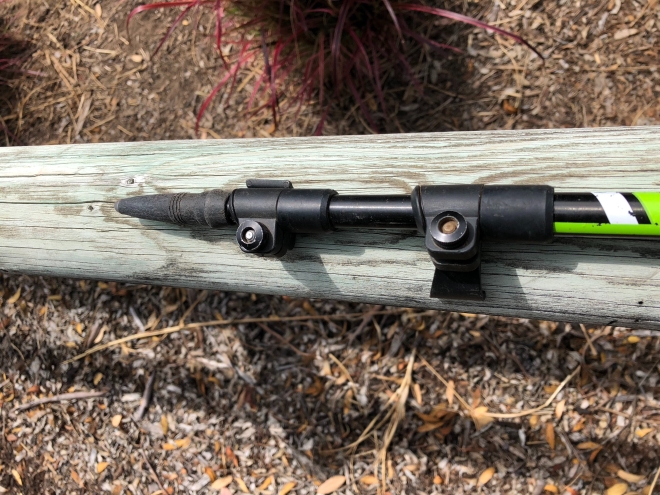
The handles/grips are comfortable, made of a hard rubber. I find myself just cupping my hands over the top of the handles just as often as I use the formal grips. Comfort all around. There’s ventilation holes and my hands do not feel sweaty.

While not part of the technical function of the pole, I do like the bright neon green color used as accent. The poles also have catchy phrases; “Enjoy Outdoor Life” and “Never Stop Walking.”

It also comes with a cool carabiner that doubles as a bottle cap opener\. This item has become part of our gear list and we use it all the time. Who wouldn’t like that bonus?

IMG_7687

Cons: This is not the set of trekking poles for a long distance hike. Each pole weighs more than 9-ounces which is well more than other poles in this market space. The shafts are made of aluminum. As a comparison, REI sells their carbon-composite poles weighing only 7.4-ounces each. Also, despite the screw-on nature of the basket, one basket did fall off and was lost within the first 100 miles of hiking.

One last note: These poles do carry some weight, as mentioned above. But if you don’t worry about ounces you carry on the trail, and you feel more comfortable with a more stable pole, these are perfect for that. A solid performer over all terrains, the weight of these poles helped provide a stable gait even over rocks.

Sincere thanks to Sweet Dreams Outdoors for the gear and for the opportunity to be part of their team.

Patti McCarthy

PCT Completion Hike – Days 48 to 64

Our last update from Yreka, CA, mentioned the smoke from fires around the area. The day after arriving in Yreka, we were having lunch at a Subway when another hiking couple came in. There is an unspoken recognition between most hikers and the four of us got to talking right away. They were hoping to ride share to Ashland, a hiker resupply point a few miles north. We mentioned that we were were hoping to connect with a trail angel we’d already been in touch with. Things worked out for all of us, with the trail angel, Bill, aka “Chanti,” giving Patti and me a ride to the trailhead and the other couple a ride to Ashland. We all spoke about the smoke and fires on the way. But not until after we gave trail names to Lightening and Thunder who told the story of being out on the trail one rainy night, when a bolt of lightening struck a tree near them. Apparently it split the tree in half.

Once on the trail, Patti and I moved onto pretty easy hiking, at least by California standards. Smoke continued to dog us that day, that evening and all of the following day. We had a short reprieve when the air seemed to clear the next day. We hiked into a dense forest hinting of the “green tunnel” some describe Oregon to be. We were also seeing a lot of burn areas, left behind from last year’s fires, where entire sides of mountains and hills were wiped clean. After just a few short days of reasonably clear air, the smoke returned. The air was hazy and the sky was gray.

One afternoon, Patti and I stopped for lunch on top of a mountain. The sky was clear. Patti went .8-mile below the trail to pick up water at a pond and carried it back, maybe 35-minutes tops. We made and had lunch, maybe 15-minutes. And we also made a phone call realizing we had service for the first time since Yreka. When we first arrived, I pointed out to Patti a cloud of smoke that was clear on the opposite ridgeline from our vantage point. In the time that passed between arriving and our leaving about an hour later, we were emerged in smoke that moved in from the opposite mountain.

I grew frustrated that each day we moved further north the smoke would move back in during the afternoon hours. There were both obvious and subtle indications of fire. The headaches and dry throats were clearly caused by the smoke we were inhaling. But a beautiful sunrise or sunset, with the sun a bright orangey red instead of a bright yellow, drew away from the fact that the color we were seeing was caused by smoke.

The burn areas also exposed a huge need for trail work to get the PCT through this region back in shape. There were downed trees crossing the trail in quite possibly hundreds of places. Fires have ravished some of the trail. It will likely take decades to correct. More funding is always needed.

One of the trail’s more famous resupply points is Crater Lake. Patti and I have been there before so knew to expect to see the bluest clearest water we’ve ever seen. It’s the signature feature of the park containing it. When we approached Mazama Village, the official resupply point within the park, the air was plenty smokey. There were lots of hikers there, perhaps 50, many of whom we’d already met. The PCT near the park had been diverted previously due to a fire last year. The original PCT segment had just reopened. However, many hikers were still choosing to do the diverted trail because it actually gets hikers closer to the rim of the crater nearest the lake. In either option, Patti and I could see that the air was smokey and from our point of view, not safe. In fact, smoke reports posted by the National Park Service were dubious. So, we decided to jump ahead, now a second time, to see if we could get ahead of the smoke. We hitched a ride and got dropped off just north of the park. This decision would prove to be significant later on. We might have thought to move even further up the PCT, perhaps giving us some space. But we wanted to limit our jump forward as it was equally important to us to do as much of the PCT as possible.

At one point, we began to hear other hikers discuss the Oregon Skyline Trail. This is a spur trail that meets up to the PCT and is, in the end, a few miles shorter. I think there is also more water along the way to collect. (A side note here, that we found Oregon to be much dryer than expected through the month.) We decided to take this trail, hoping to see a little more of Oregon than we had. Along the way, we found some great lakes to stop at. One lake, Bingham Lake, was just a short distance from the OST. We found it and had the entire lake to ourselves. It was shallow and warm. We were able to collect water, freshen up and do some “laundry” all in one stop.

We were growing excited to get to our next resupply point, Shelter Cove. There we would receive a box full of goodies and get a chance to eat something other than trail food. We took showers, did real laundry, ate at the restaurant and shopped in the general store before settling in for the night at their campsite. The staff there was great. They were very accommodating to hikers. They have a tent and charging station available for hikers, along with picnic tables, a microwave, hiker boxes and trail registry. The WiFi, however, was painfully slow.

We began meeting other hikers, though not a lot of them. Those of us on the trail, despite the smoke, seemed resolved to wait and see how things would develop, and to continue hiking in the meantime. We began picking up more strength and endurance. We built our daily mileage up to 16-18 miles per day comfortably, and up to 20-22 on good days. We caught up with one hiker we met at Crater Lake, Tequila John. We would later leapfrog him several times before we all decided to hike together. We enjoyed having a fresh voice to speak with. We got acquainted quickly.

Photos on instagram.com/mcshap