8/27/15 – 9/5/15
55 miles
Northbound
Mileage driven 590
Change in Plans
This is part three from our last hike. We just finished a keep-in-shape hike on the Trans-Catalina Trail so stay tuned…
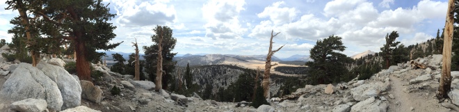
We knew Horseshoe Meadow (HSM) to Mammoth would be hard; our longest trip in both miles and number of days. We were looking forward to this segment. We expected the beauty of this section to overshadow the work to get there. In the end, it was the smoke from the Rough Fire (discussed in a prior post) that overshadowed it all.
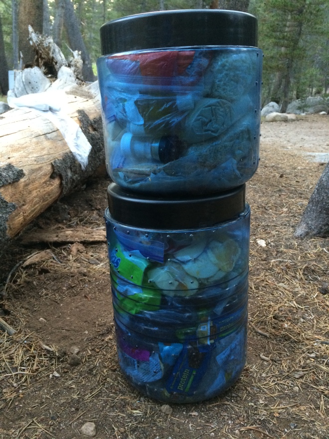
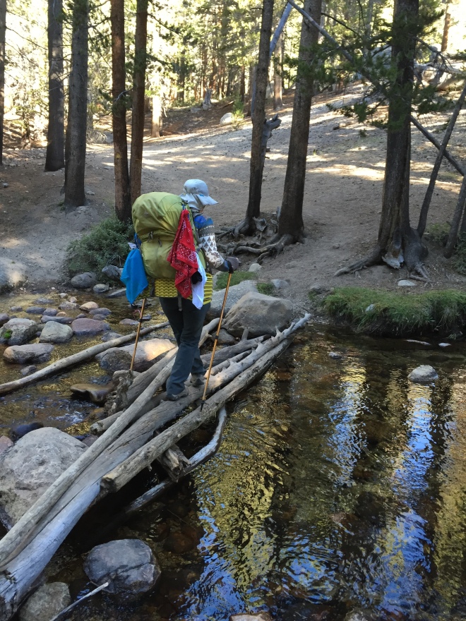
We prepared to leave Thursday September 27th. Our final pack weight was 28% of our body weights. We were required by the park to carry bear vaults to ward off unwelcome visitors. The vaults alone add a lot of weight! We had one regular sized vault which Lynn carried and purchased a half-size vault that I carried. We had 12 days of food packed in,tight.
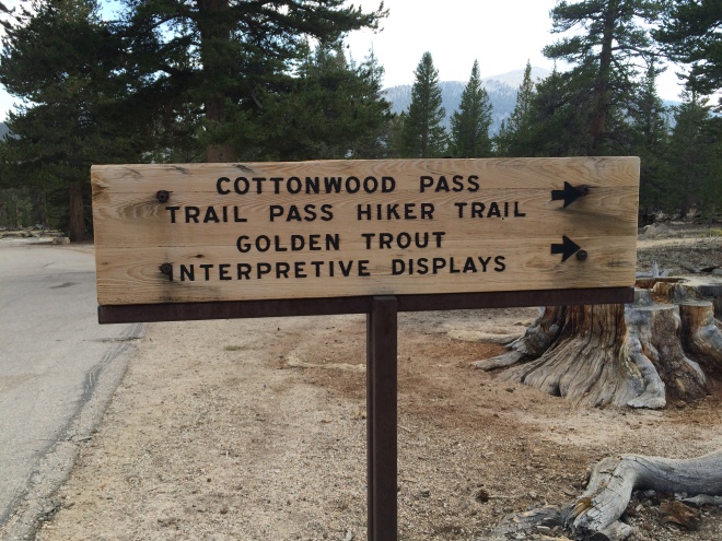 After a long drive and long visit with the ranger to get our permits, we made it to Horse Shoe Meadow around 5:15. We hiked three miles into Cottonwood Pass in about two hours before it was dark. Lynn struggled with altitude adjustment. As purists, we should have hiked south to Trail Pass, where we started the last time. But we wanted to pack on miles. We traded those five miles that it would have been to head south to pick up the trail at the Trail Pass cut-off, with five miles it took to take the north cut-off to the PCT from HSM. So it all balanced out. I also gave up being a purist.
Lynn was still struggling the next day adjusting to the altitude and finding himself winded. My mantra for the day was “Just breathe.”
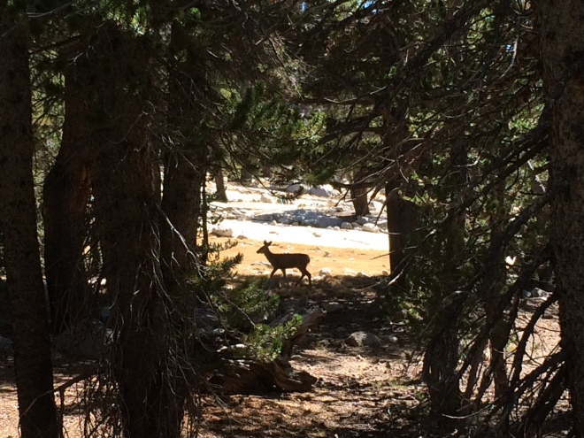
Approaching the section where the John Muir Trail (JMT) meets the PCT, we met a lot of hikers, mostly south bounders. Quite a few of the hikers were finishing the trail, or heading towards Mount Whitney, or both. When we normally hike, we see less than a handful of hikers. We also saw more wildlife than usual. We saw three deer that day, to start.
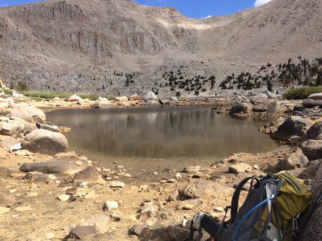
 We hiked 10.7 PCT miles for the day, plus one to get onto the trail. We felt pretty good since we were out-of-practice hikers. At Chicken Spring Lake we had lunch and filled up with water. So far, water was not an issue. But we were not able to completely let go of the need to carry excess water. That night we camped out at Rock Creek. From Rock Creek on through the hike, we found campsites near a creek and with a bear box. Made me wonder why I had to carry a bear vault but I know it’s for safety. The nicest thing about sleeping next to a creek is the sound of water flowing as you drift off to sleep. Better than a Tylenol PM.
 On Saturday, we covered 10 miles in 10 ½ hours. I noticed I didn’t have to think about what I was doing in packing up. “Second nature” was my mantra for this day. The path turned to a nice dirt trail. Redwood trees and mountain scenes everywhere. It was gorgeous. At Crabtree Meadow we watched a doe and her fawn. This is the point where the two trails meet.
 There were a lot of guided tours on the trail. One young, very energetic guy, asked us to encourage the others down the trail. I thought he meant just the next hiker. So, we cheered the exhausted woman that trailed behind several hundred yards. “You can do it! Go, go, go!” It wasn’t until we stopped to talk to another guy – after ten more hikers passed, who all looked miserable – did we find out it was a guided tour. He was bringing up the rear and had a guitar on his back. That young energetic guy up front was leading the group. This guitar-playing hiker had to stop because he was waiting for the last hiker. She was an older woman who did not have a lot of experience. She was “really slow but steady” according the guide. But she had a big smile on her face as she passed by and the guide moved on with her.
 More deer, more hikers and we met a ranger on the trail. I know that sounds odd, but we rarely see rangers on the trail. In over 700 miles, I recall only seeing one ranger, near Mt. Jacinto, leading a small group tour.
We did run into one southbound PCT thru-hiker, Iceman. It was nice having a different kind of conversation with him.
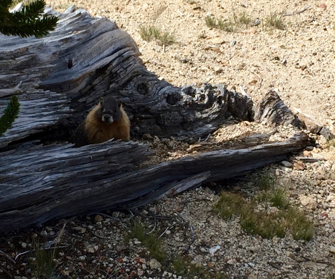
Sunday, we got an early start. Only the trail, or some life-threatening crisis will get this night owl up. There were more deer. We started seeing yellow bellied Marmots. Marmots seemed to love attention and posed for us as we snapped plenty of pictures.
 We met up with another ranger. While checking our permits (we were shocked we were asked for our permits, but the JMT is so heavily traveled that it’s monitored unlike the PCT), the ranger asked if we had enough food. We told her we thought we likely brought too much. She then said, although we weren’t suppose to do this, if we left extra food in the bear can at Tyndall Creek, she would take it to the station for other hikers who on occasion show up low on food. We were so thrilled to hear that.
At Tyndall Creek we had lunch and filled up. With signs of water everywhere, I was finally able to convince Lynn he didn’t need to carry 11-pounds of water. We were good with 1-2 liters. At this point, we finally learned to stop at a stream for lunch and dinner so we didn’t need to carry the extra water weight. Habits from our last hike from the fear of not finding water, really stuck for awhile.
By this time, another hiker, Molly, came up and talked with us. She was doing the JMT with her sister, Claire, and cousin Katie. They were very inexperienced. But had done a lot of homework and local hikes near their homes. They also were told by “some professional” they should follow the Knowles pantry method for food. This method recommends you carry 1½-pounds of food per person per day. They had one resupply planned at Independence off Kearsarge Pass, but had started the hike with over 50-pounds on her back. She showed me a recipe book she was carrying. Clearly, they had too much food. I told her what the ranger offered and suggested to do this quick before the ranger got here. Concurrently, Lynn was enjoying one of his Jolly Ranchers. Molly’s eyes lit up so Lynn gave her a handful. She went down and came up, with her sister and cousin, right as the ranger was approaching. Talk about timing for her. She had a large bag of flour, milk, oatmeal and tvp. I bet she had at least 5-pounds of food she gave away. Funny story about Katie: She was napping while Molly was speaking with Claire and could hear Molly talking but not what she was saying. That is, until she said “Jolly Rancher.” She shot straight up and exclaimed, “You have Jolly Ranchers?”
Unfortunately there was too much smoke from the Rough Fire to go on and the rest of our day was spent at Tyndall. The ranger recommended we start early in the morning to beat the smoke. The next day, Forester Pass was on our agenda so we took her advice and started early again.
We ran into a few more hikers. We asked about the girls. We were a little worried about them, in a big sister/brother kind of way. They left camp about 10-15 min before us but we thought we would catch up to them. Each hiker we asked noted how unprepared they seemed. But it was a good natured kind of rib.
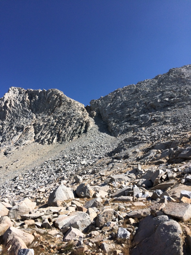 The next pass to tackle was Glen Pass. At Forester, hikers told us that Glen Pass was harder than Forester. To which I would reply, “Don’t harsh my mellow!” I don’t know if Glen Pass was any tougher, but I think whoever named it after Glen must have hated him. It was brutal. ALL ROCKS. It seemed like it was taking forever to get there and indeed it took nearly six hours for us to get to the top. However, the view on the other side, away from the rock quarry, was even more beautiful than Forester. Below us was a pristine blue, Rae Lake.
 More wildlife to see. There was a bird that looked like a jay but sounded like a crow. I found these birds fascinating. They were too quick for me to take a picture. I saw one fly off with prey in its mouth. I found out they are Clarke Nutcrackers.
 At Baxter Pass I took my first spill in a stream. Lynn thought he saw a ring in the water. He struggled to reach it so I offered and promptly slipped on a rock. I was soaked knees to my toes. It did look like it could be a simple engagement ring. Turns out it was a mini wine cork ring. So worth the effort!
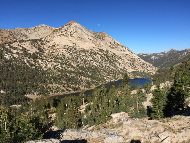
Our next pass was Pinchot Pass. This pass was much nicer to climb. Still hard but nicer. We saw pikas. These animals, like the Nutcrackers, were too fast for a photo-op.
By this time, the smoke was on us all day. Lynn had a headache. I was nauseous. We knew it was just time to call it. We were incredibly fortunate to meet Eliot, a park employee working to save a frog. He not only informed us of a rarely mentioned trail to get off trail. It was a short distance from where we would camp that night, and lets out at Independence
It took 2 days to get all that smoke off. Overall the JMT was pretty, had a lot of hikers, and a lot more trash than we normally see on the PCT, sadly. But there was wildlife which we rarely see.
The final count:
20 deer (3 bucks and 6 fawn)
Chipmunks, pikas, clarke nutcrackers,
3 horses, one mule
10 marmots
3 rangers
153 hikers.
Patti